CCIS Civitas
Civil & Infrastructure Solutions
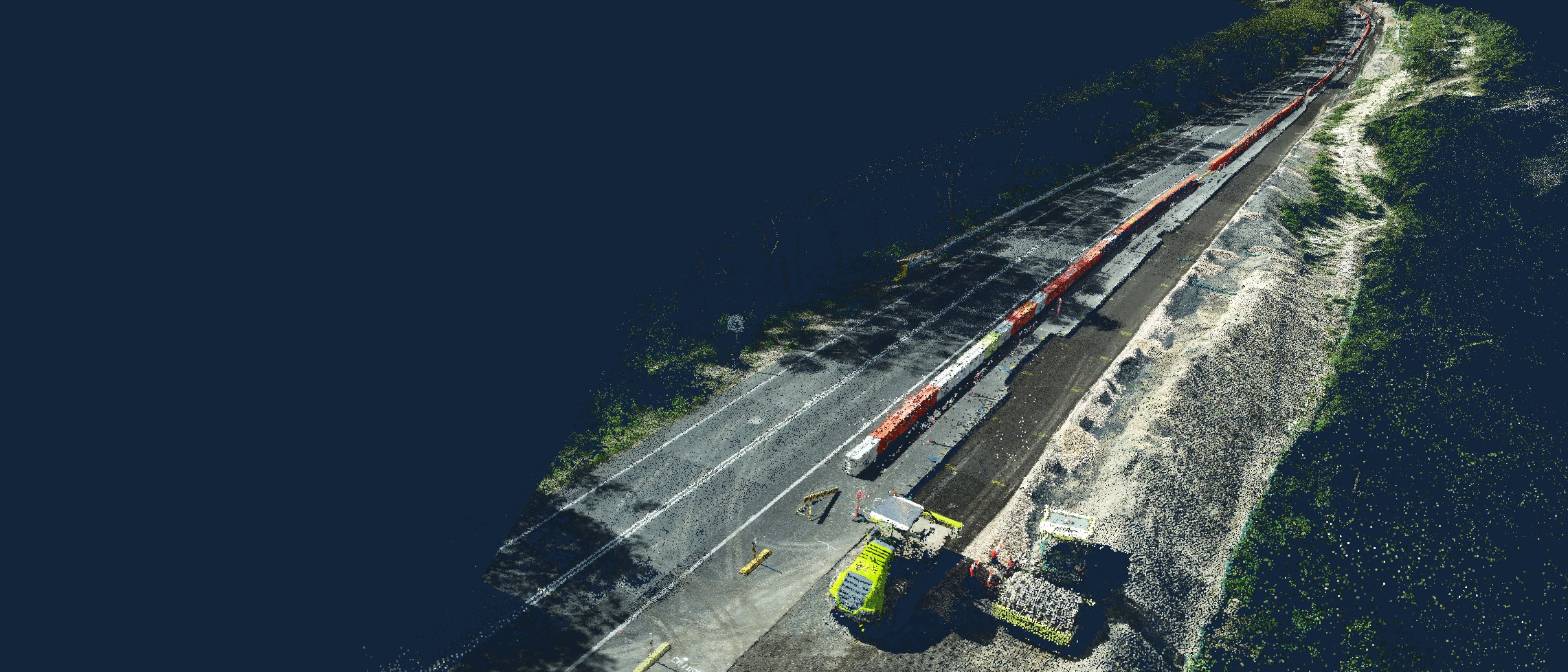
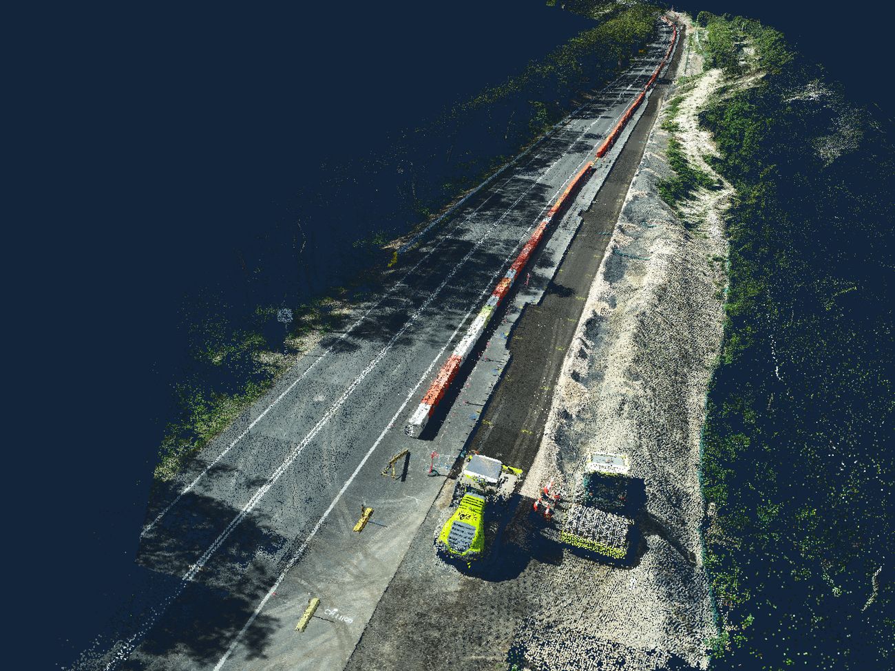
Point cloud of a road reconstruction site captured by RTK drone, showing pavement works, barrier line and plant

Newcastle · Central Coast · Hunter

Site data and delivery support for people who build the thing.

RTK drone mapping, slope and asset inspections, and construction support — from a team who have run teams on site, not just the drawings.

27yrs
Combined construction
& operations experience
48hr
Reactive inspection
attendance
5day
Standard mapping
turnaround
±30mm
Checkpoint-verified
accuracy
01

What we do

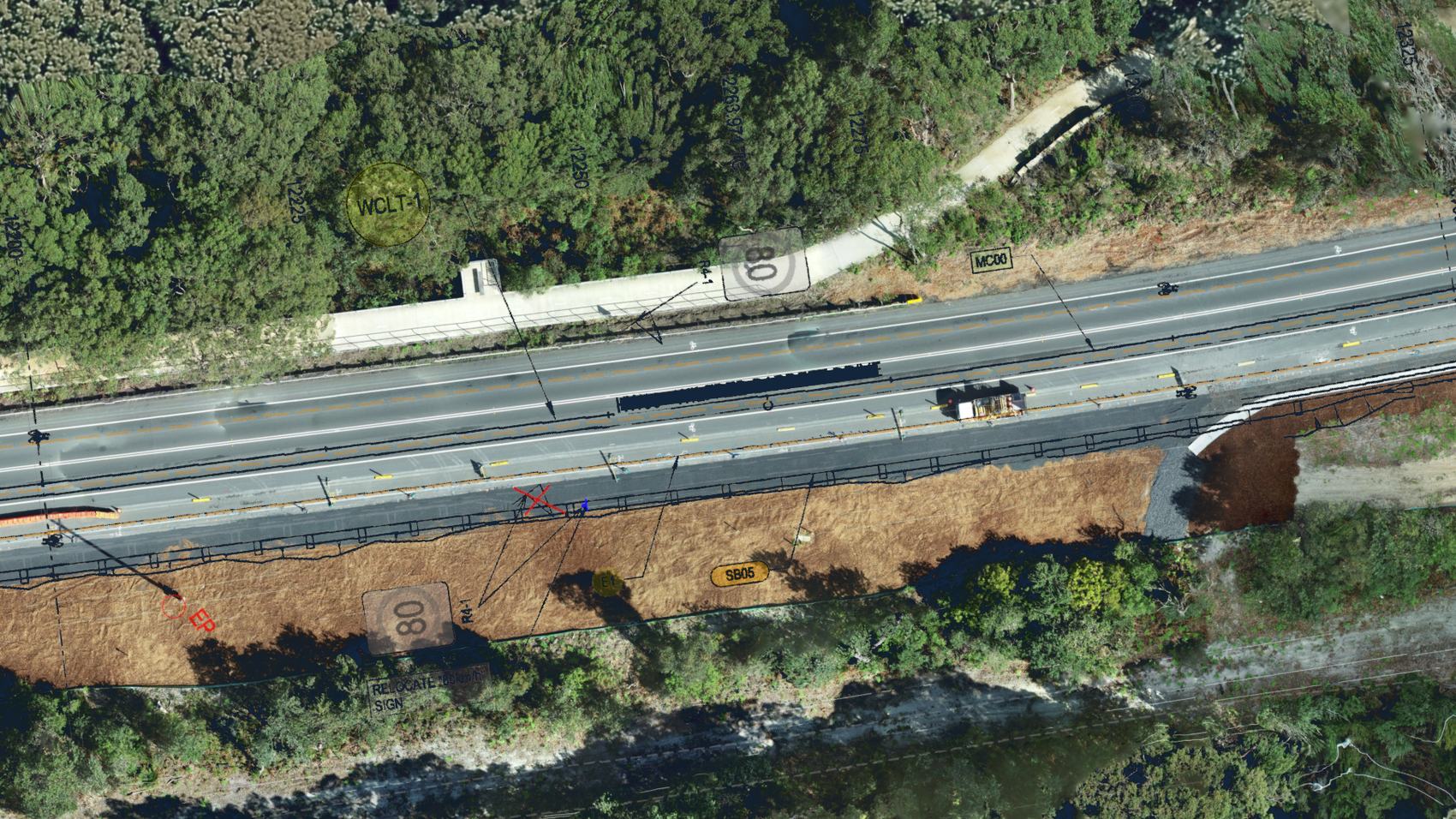
Orthomosaic of a highway widening with the design overlaid — chainages, batter extents, drainage marks and a sign relocation noted against the survey

Construction Support

Constructability, programming and estimating from someone who has built the work, not just priced it.

  • Constructability & safety-in-design workshops
  • Programming and staging
  • Estimating and cost planning
  • On-site project management
  • Design review and utility staging
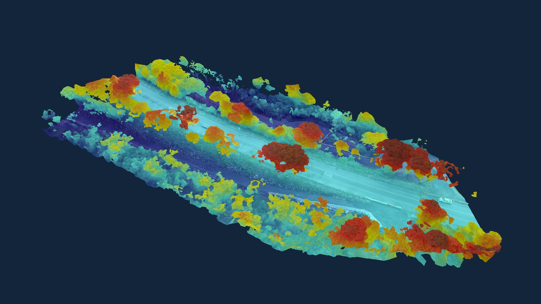
Elevation-classified point cloud of a road corridor, coloured by height from the ground surface

Drone Mapping & Modelling

RTK-flown orthomosaics, 3D models and point clouds, delivered in the formats your team already uses.

  • Orthomosaics and progress imagery
  • Stockpile and cut/fill volumetrics
  • 3D models and point cloud deliverables
  • Ground control and checkpoint capture
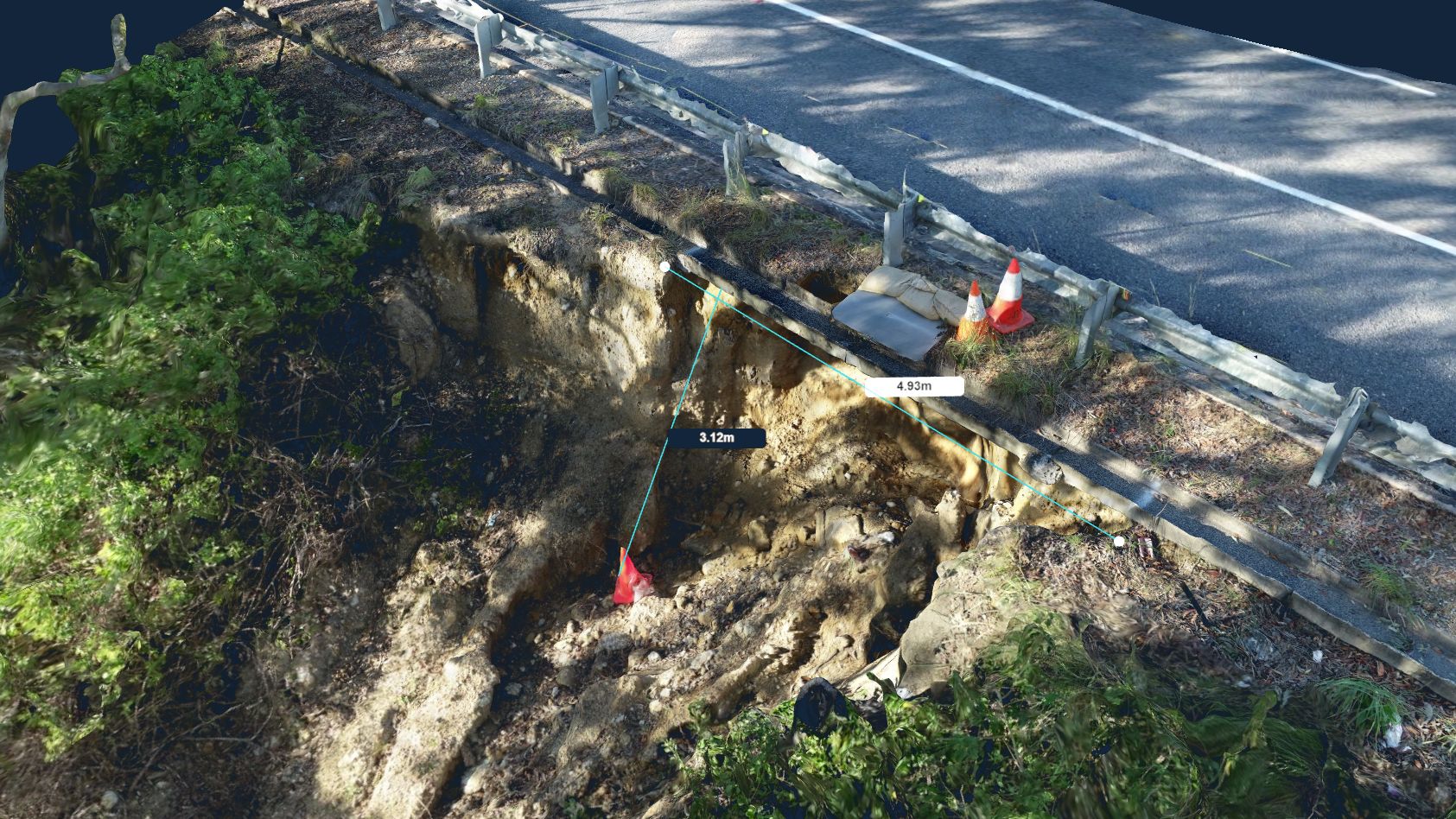
Textured 3D model of a road embankment failure with the scarp measured at 3.12 m depth and 4.93 m width

Infrastructure & Asset Inspections

Condition capture on assets that are hard, slow or unsafe to reach from the ground — including slopes you can't safely stand on.

  • Slope and embankment failure assessment
  • Slope mosaics for defect marking and remediation scoping
  • Culvert and headwall condition assessment
  • Structure and elevated asset imagery
  • Inspection reporting and risk registers
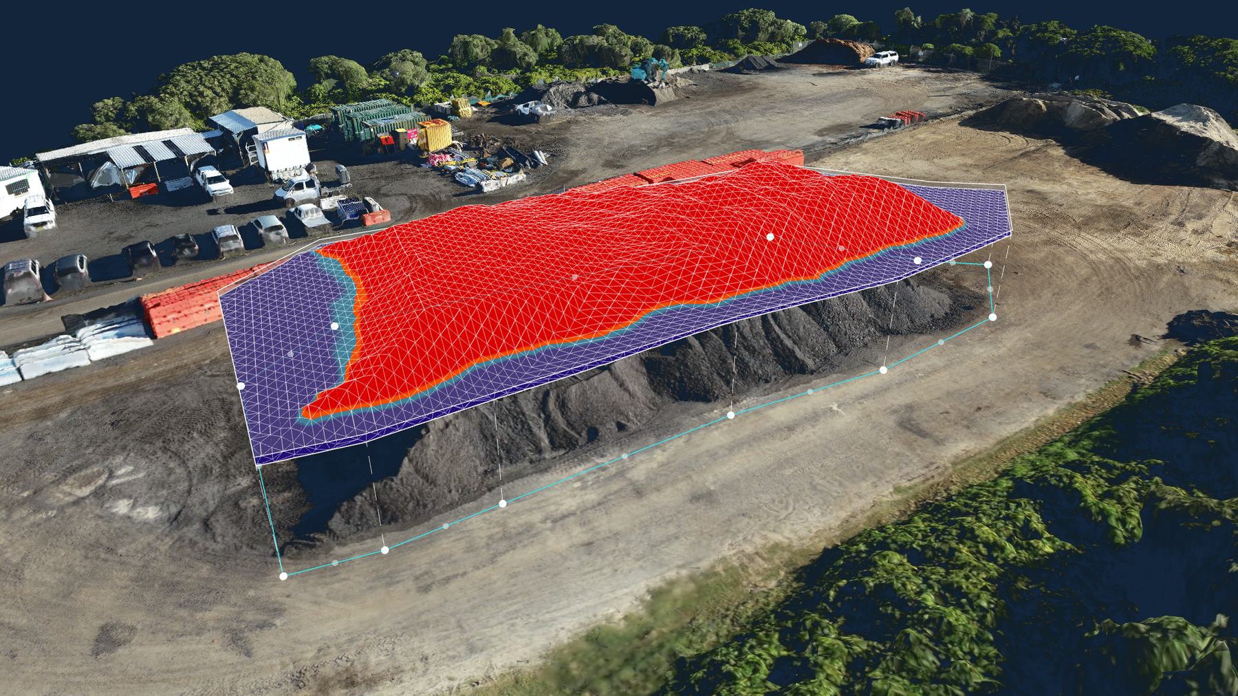
Stockpile volumetric surface generated from drone capture, with the computed surface overlaid on the material

Project Systems & Assurance

The documents that let a job start and survive an audit — written by people who have been audited.

  • Project management plans and ESCPs
  • ISO-aligned system development
  • Auditing and system health checks
  • Incident investigation
  • Contract management support
02

How a job runs

Four steps from first call to data in your hands. Most mapping jobs turn around inside a week.

01

Scope

A short call to confirm the site, the deliverable and the accuracy you actually need. Not every job needs ground control — we'll tell you when it doesn't.

02

Fly

RTK capture with checkpoints where the job warrants it. Inductions, JSEA and CASA compliance handled before we arrive.

03

Process

Ortho, 3D model, point cloud or volumetrics — checked against the checkpoints before anything is issued.

04

Deliver

Files in your formats, with a note on accuracy achieved and anything on site worth your attention.

Start with a scope call

Tell us the site and what you need to see. If we're not the right fit, we'll say so on the call.

Get in touch
SERVICES

Service lines

Four lines, and the detail behind each — what you receive, who it suits, and how long it takes.

Orthomosaic of a highway widening with the design overlaid — chainages, batter extents, drainage marks and a sign relocation noted against the survey

Construction Support

Constructability, programming and estimating from a chartered engineer who has run the crews. The value is knowing what will actually happen on site, not what the drawing says should.

What you receive

  • Constructability and safety-in-design workshop, with a written outcomes register
  • Construction programme with staging, float and critical path identified
  • Cost estimate with rates, assumptions and exclusions stated
  • Design review commentary against buildability and utility conflicts
  • On-site project management, by the day or by the package

Who it suits

  • Councils scoping a job before it goes to tender
  • Contractors pricing work with unfamiliar staging
  • Designers wanting a build-side review before IFC

Turnaround

Workshops within two weeks of engagement. Estimates and programmes typically 5–10 business days depending on scope.

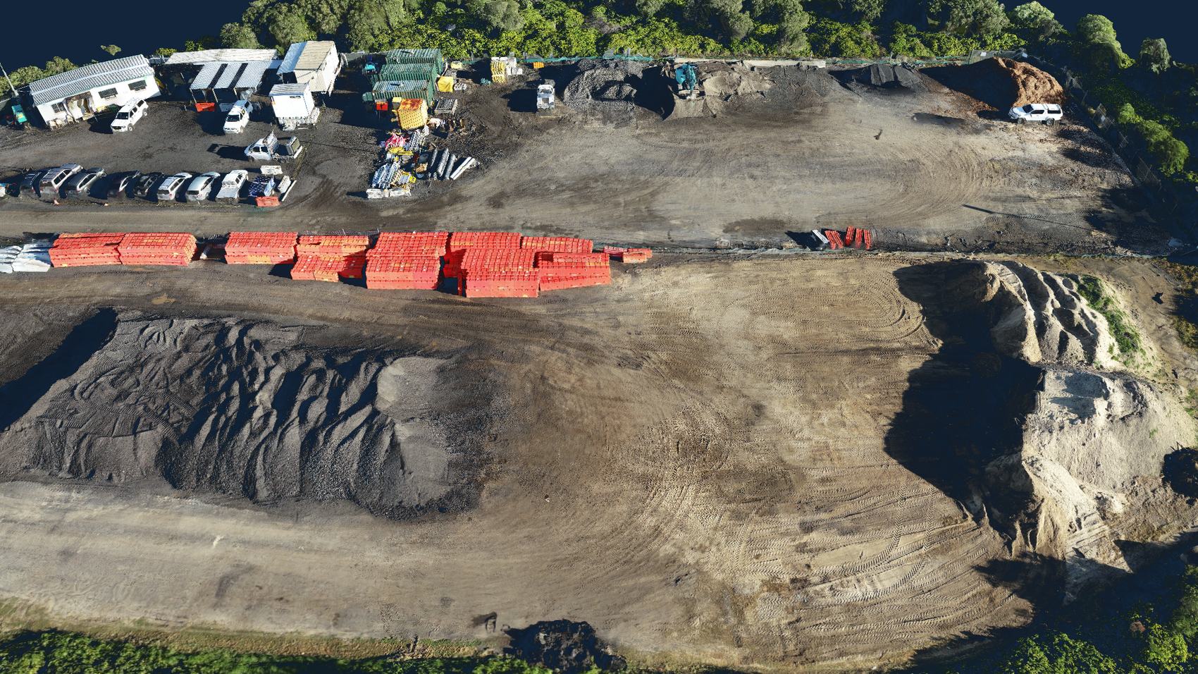
Orthomosaic of a works depot showing stockpiles, barrier stock and hardstand

Drone Mapping & Modelling

RTK-flown capture, processed into the measurement products your team already works with. Ground control where the accuracy warrants it, and an honest answer when it doesn't.

What you receive

  • GeoTIFF orthomosaic, georeferenced to your project datum
  • Point cloud (LAS/LAZ) and textured 3D mesh (OBJ)
  • Digital surface model and contours
  • Stockpile and cut/fill volumetrics, with method and datum stated
  • Accuracy statement for the flight, checked against independent checkpoints

Who it suits

  • Contractors needing monthly progress and quantities
  • Councils tracking stockpiles and asset condition
  • Designers wanting existing surface before survey pickup

Turnaround

Standard sites flown and delivered within 5 business days. Progress imagery next business day where the job is already set up.

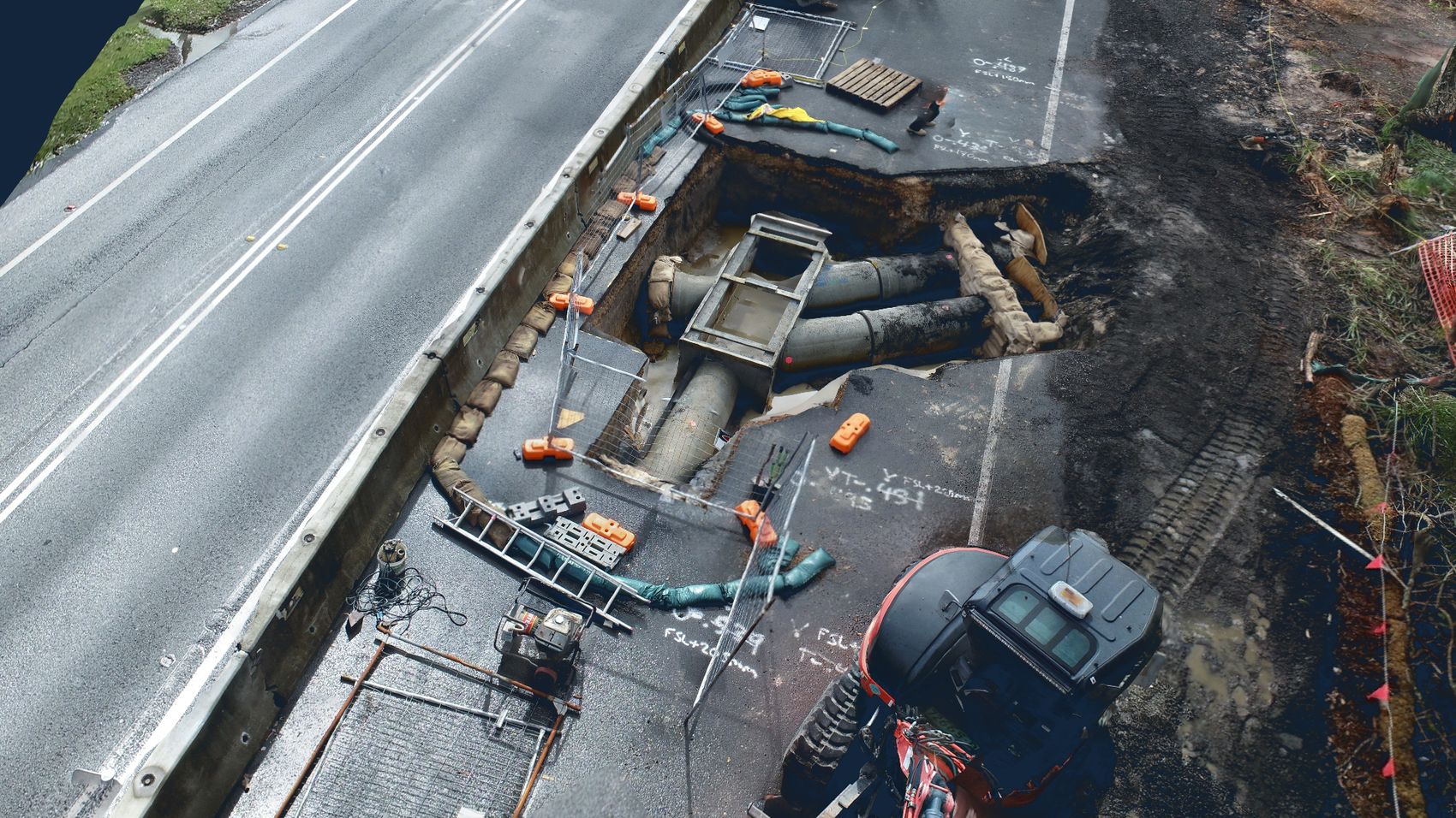
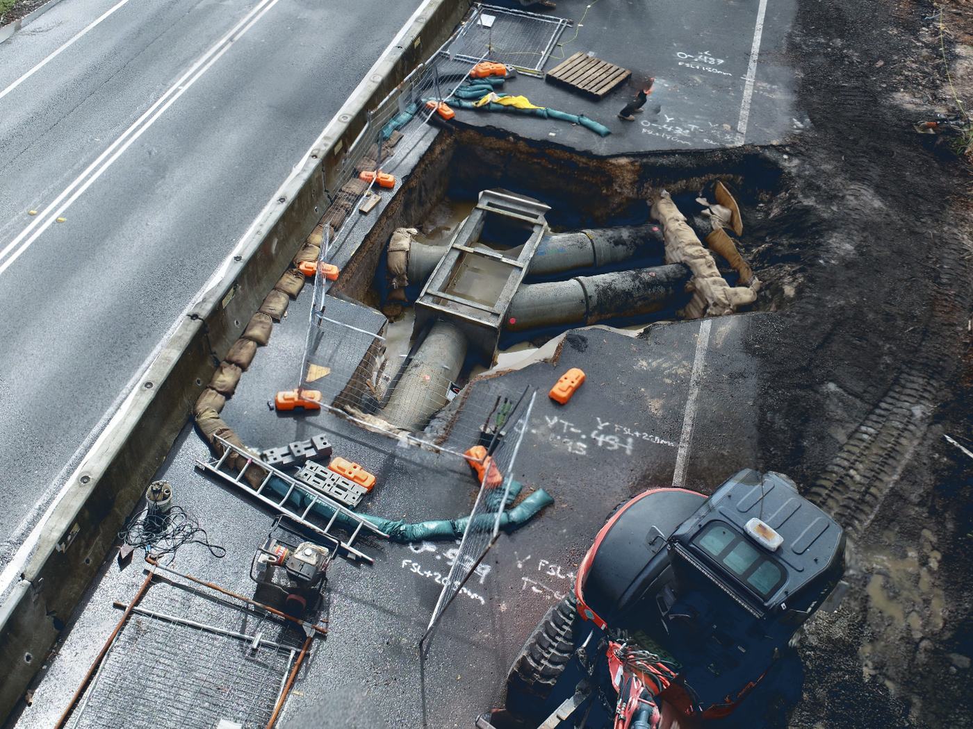
Drone model of a stormwater excavation beneath a road shoulder, showing exposed pipework, pit and shoring alongside live traffic lanes

Infrastructure & Asset Inspections

Condition capture on assets that are hard, slow or unsafe to reach from the ground — including slopes nobody should be standing on.

What you receive

  • Slope and embankment failure assessment — modelled, measured, not eyeballed
  • Culvert, headwall and drainage structure condition imagery
  • Bridge soffit, retaining wall and elevated asset capture
  • Roof and building envelope inspection
  • Pavement, kerb and footpath defect capture
  • Pre- and post-works dilapidation records
  • Defect register with location-tagged imagery and risk rating

Who it suits

  • Council asset teams with inspection backlogs
  • Geotechnical consultants scoping a slip before mobilising
  • Anyone facing a confined-space or working-at-height task that a drone removes

Turnaround

Reactive inspections attended within 48 hours where access permits. Reporting within 5 business days.

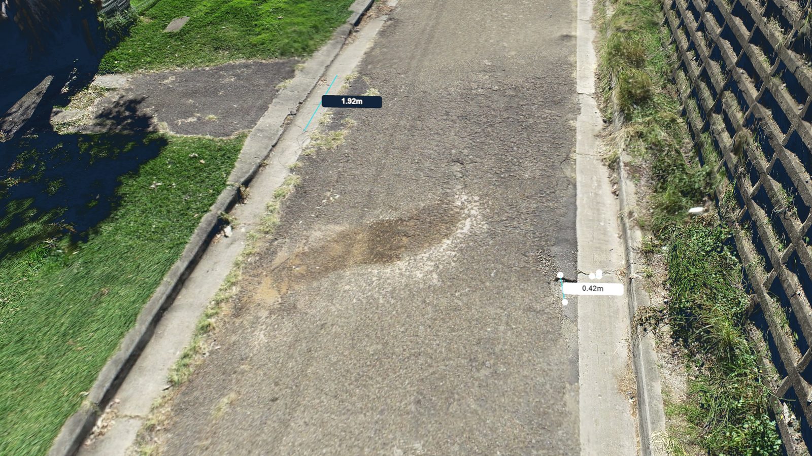
3D model of a residential street with a pavement defect and kerb displacement measured at 1.92 m and 0.42 m

Pavement & dilapidation reporting

The same capture that inspects a bridge soffit works on a suburban street. Defects are located and measured off the model rather than paced out and estimated — and the whole surface is recorded, not just the parts someone thought to photograph.

Reports we produce

  • Pre-works dilapidation surveys of roads, kerbs, driveways and adjoining property frontages
  • Post-works comparison against the pre-works record
  • Pavement defect registers — cracking, rutting, edge break, patching and displacement, each measured and located
  • Kerb, gutter and footpath condition and displacement
  • Asset condition capture to feed a renewal programme

Why it settles arguments

Most dilapidation disputes come down to whether a crack was there beforehand. A dated, measurable model of the whole frontage answers that in minutes instead of becoming a claim.

Also suits

  • Contractors protecting themselves before works near private property
  • Councils building a defect baseline across a street or precinct
  • Insurers and assessors needing an independent record

Slope mosaics & failure inspections

Rock faces, batters and embankments inspected at close range without an elevated work platform, rope access team or lane closure. The face comes back to your desk as a measurable model — and stays there, so it can be re-examined without going back to site.

No platform, no rope access

EWP hire, traffic control and a working-at-height crew often cost more than the inspection itself. A flight removes all three.

Nobody on the face

Unstable ground is inspected without exposing anyone to it — which is usually the reason the inspection was being deferred.

Revisit without remobilising

The model is a record. Take another measurement, check a feature you missed, or brief a colleague — months later, from the office.

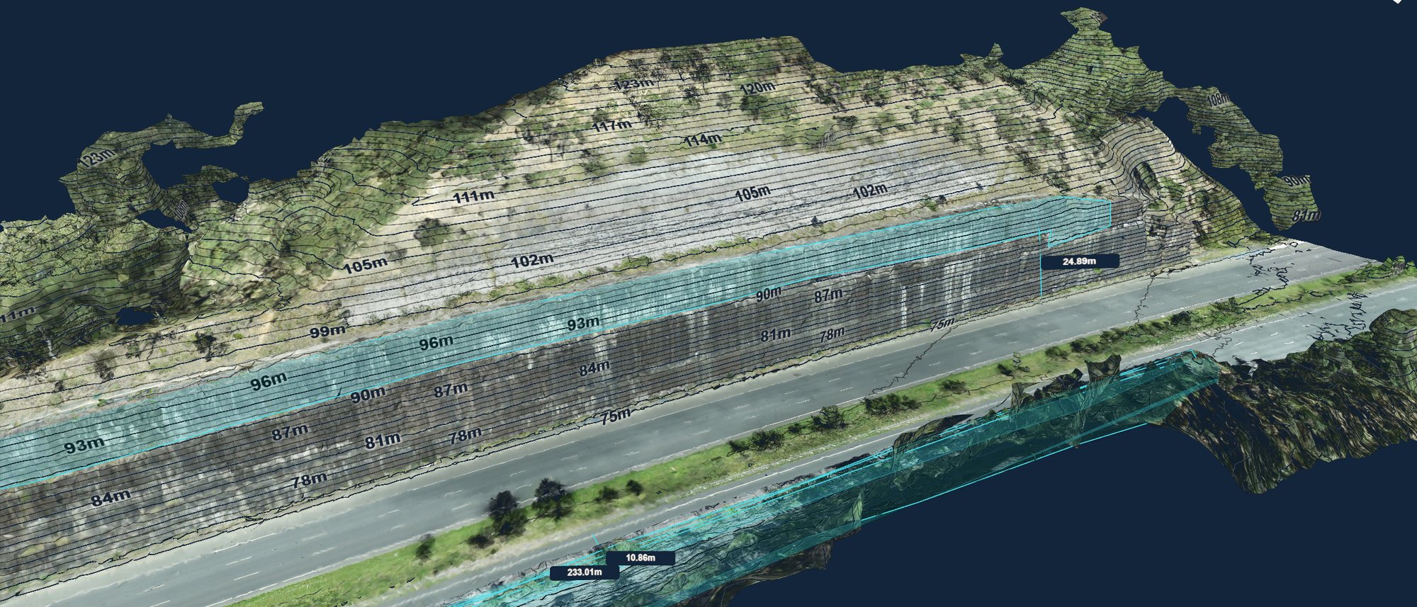
Contoured 3D mosaic of a rock cutting beside a highway, with elevation contours and a 233 m section length annotated
A

Slope mosaics & defect marking

A full-face mosaic of the cutting or batter, contoured and to scale, so features can be located, measured and marked up without anyone leaving the ground.

Used for

  • Scoping rock bolt, mesh, dowel and shotcrete extents before pricing
  • Locating and measuring joints, blocks, overhangs and loose material
  • Marking defects against chainage and level for a scope of works
  • Establishing a face record before and after remediation
  • Briefing a contractor on access and staging before mobilising
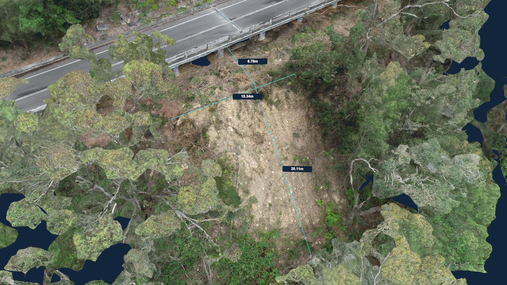
Textured 3D model of a slope failure below a bridge abutment, with the scarp measured at 20.11 m long and 15.34 m across
B

Failure modelling

When a slope lets go, the first question is how big. Flown and modelled the same day where access allows, so the extent is measured rather than estimated — before the weather changes it again.

  • Scarp dimensions, slip extent and affected batter length
  • Volume of displaced material for haulage and disposal estimates
  • Proximity of the failure to pavement, abutments and services
  • A measurable record for the geotechnical brief and for the claim file
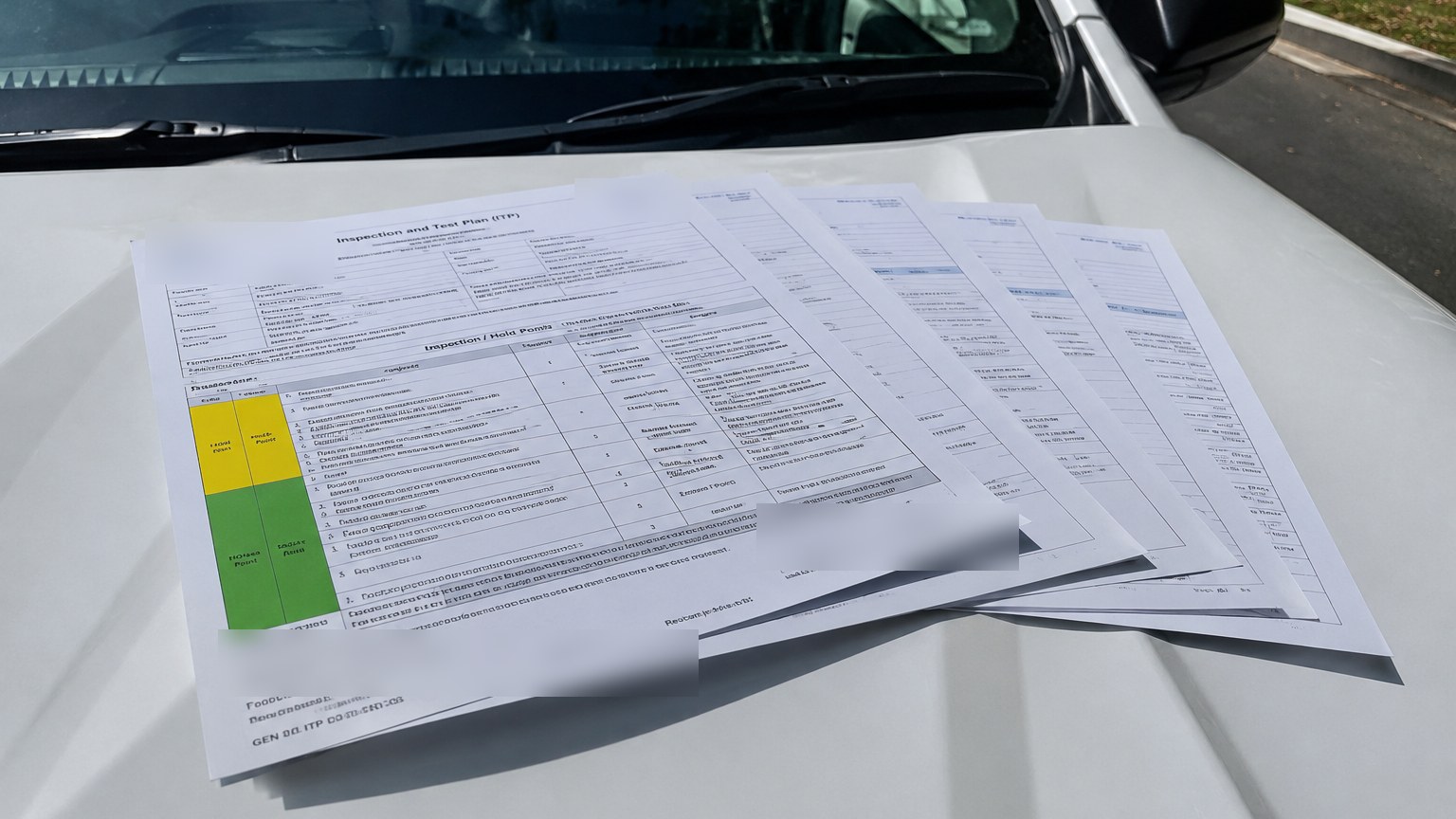
An Inspection and Test Plan with hold and witness points marked, laid out on a vehicle bonnet on site

Project Systems & Assurance

The documents that let a job start and survive an audit — written by people who have been on both sides of the audit.

What you receive

  • Project management plans, ITPs and lot packages
  • Erosion and sediment control plans
  • Traffic management and environmental documentation
  • ISO-aligned system development and gap analysis
  • Internal audits, system health checks and close-out
  • Incident investigation and corrective action tracking

Who it suits

  • Small contractors needing compliant documentation to win council work
  • Councils and businesses building or repairing a management system
  • Organisations facing certification or a client audit

Turnaround

Document packages typically 1–3 weeks. Audits scheduled to your certification dates.

Credentials

Held by the people doing the work, not the letterhead. Each is verifiable with the issuing body on request.

Chartered Professional Engineer Engineers Australia — Civil & Construction
Integrated Management Systems Lead Auditor Certificate of Attainment — Exemplar Global competency units, 2026
ICAM Lead Investigator Safety Wise Solutions
Remote Pilot Licence (RePL) Civil Aviation Safety Authority

Auditing to international standards

Lead auditor competency across quality, environmental and OH&S management systems, assessed against the Exemplar Global units below. We build and audit systems aligned with these standards — alignment is not certification, and we prepare organisations to meet the standard and withstand third-party audit against it, rather than issuing certification ourselves.

ISO 9001Quality management
Exemplar Global QM
ISO 14001Environmental management
Exemplar Global EM
ISO 45001Occupational health & safety
Exemplar Global OH 45001
ISO 19011Auditing management systems
Exemplar Global AU
ISO 19011Leading audit teams
Exemplar Global TL

Not sure which line you need?

Describe the site and the problem. We'll tell you which service fits, or that none of them do.

Get in touch
PROJECTS

Project experience

A cross-section of recent work — corridor mapping, earthworks, drainage, slope assessment and pavement.

Orthomosaic of a works depot showing stockpiles, barrier stock and hardstand
Stockpile volumetric surface generated from drone capture, with the computed surface overlaid on the material
Stormwater pit and pipework exposed in an excavation beside a guardrail
Point cloud of a road reconstruction showing bulk earthworks, barrier line, subgrade and plant
Textured 3D model of a slope failure below a bridge abutment, with the scarp measured at 20.11 m long and 15.34 m across
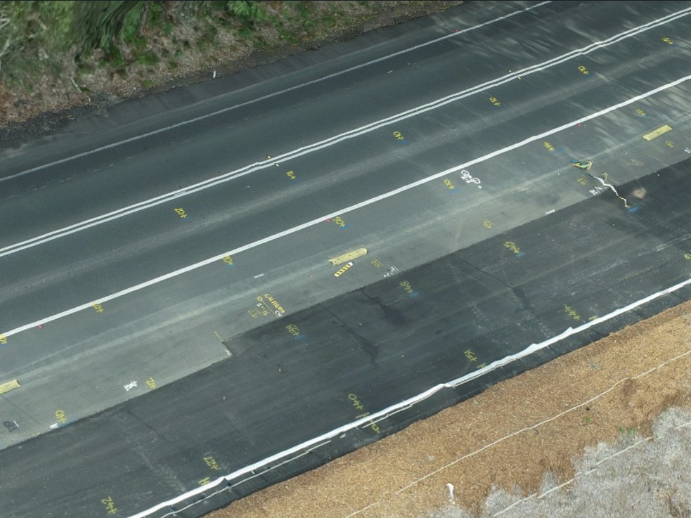
Freshly paved asphalt lanes with survey markings and chainage set out across the mat
ABOUT

Who you're dealing with

Small by design — you deal with the people who do the work, not an account manager.

Portrait of Mitch McClelland, engineering and delivery director Engineering & Delivery

Mitch McClelland

Chartered civil and construction engineer across public infrastructure — intersection upgrades, asphalt works, signals, utilities, stormwater, earthworks and pavements.

Time on both sides of the fence: running construction crews on the delivery side, and client-side in local government where the questions are entirely different. Delivery wants a programme that survives contact with the site and a scope that stops moving. The client wants to know what actually happened this week without standing in the middle of it.

Routine capture answers both. The crew keeps working, and the principal sees progress, quantities and emerging issues from their desk — which means fewer site walks to find out what a photo already could have shown, and fewer surprises at the end of the month.

  • Constructability, programming, estimating and staging
  • ISO-aligned management systems and lot packages
  • Contract management and superintendent support
  • Asset management, condition assessment and renewal planning
  • Incident investigation and corrective action close-out
  • CASA remote pilot licence — RTK mapping, modelling and inspection

Portrait of Taylah Robards, assurance and change director Assurance & Change

Taylah Robards

Over 15 years in construction contracting, operations optimisation, logistics, systems and change management. The work of getting an organisation to actually run the way its documents say it does — and finding out why it doesn't.

  • Operations optimisation and process redesign
  • Logistics, supply and materials management
  • Management system development and implementation
  • Change management and business transformation
  • Internal auditing and system health checks
  • Incident investigation and root cause analysis
CONTACT

Request a quote

Tell us the site and the deliverable. We'll come back with a scope and a price, usually same day.

Direct

Email admin@ccis.com.au
Area Newcastle, Central Coast & Hunter

Insured and CASA-compliant. Certificates of currency available on request.